
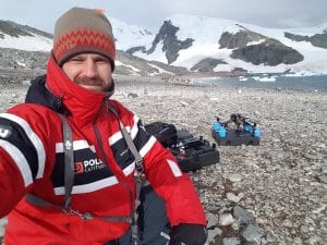
In early 2018, Dr. Eric Saczuk spent 14 days in Antarctica assessing the feasibility of using drones to collect vital climate change data: “Can drones be used effectively to study animal behaviour, to study the topography, the physical environment in Antarctica? Are they a useful tool? Are the sensors that can now be attached to drones useful in that type of harsh environment?” (Global News interview).
With BCIT grants to cover the costs of travel, Eric’s goal was to test the feasibility of using colour, multispectral, and thermal sensors attached to an RPAS to record and monitor glacial surfaces, wildlife, and the status of vegetation in the western Antarctic Peninsula. He used the images he captured to create meaningful map products, including topography, estimation of ice/snow volume, penguin counts based on thermal imagery, and baseline data of the current extent of glaciers.
Bringing research back to the classroom
This expedition was a rare opportunity to showcase BCIT’s ability to carry out international research. It also allowed Eric to capture a unique data set for processing and incorporation into existing Geomatics and Forest and Natural Areas Management courses.
Eric hopes that his research will help BCIT students “benefit from the lessons learned and the data acquired in order to better equip them to deal with the challenging and dynamic work environment they face in today’s competitive job market.”
A global community of “citizen scientists”
In his Antarctica research travels, Eric met many like-minded people committed to combatting the effects of climate change in the world. One such person was Sunniva Sorby, whose Hearts in the Ice (HITI) foundation provides a platform for social engagement connecting “students, scientists, manufacturers, environmental organizations, and all who care about the health of our planet, in the conversation around climate change.”
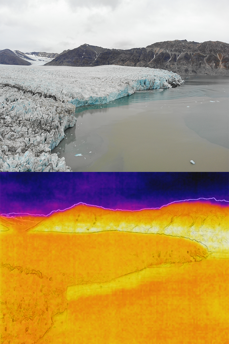
Eric contributed expertise and training in using RPAS to gather data for one of HITI’s citizen science research projects. His role was to investigate the application of RPAS with a forward-looking infrared (FLIR) sensor to map the surface temperatures of a glacier in Svalbard, Norway, where a deadly avalanche occurred unexpectedly in 2015. Sunniva and HITI partner Hilde Falun Strom plan to measure the effects of increasing arctic temperatures on the glacier over the span of six months.
Read more about Eric’s engagement with HITI in the BCIT News article, “BCIT Researcher Using Drones to Study Climate Change in Norway,” and in Canadian Geographic, “Hearts in the Ice: Drone Technology.”