—March 2022
Modeling campus for engineering study
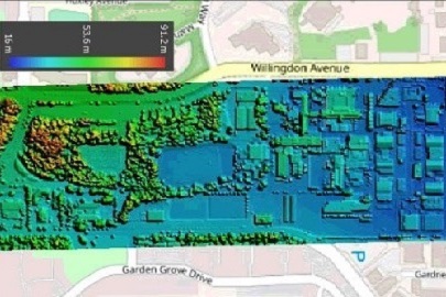
An engineering firm conducting a storm water management study for BCIT used RPAS Hub expertise to collect data for a storm water run-off model.
To assist Stantec engineers, Eric Saczuk flew a DJI Inspire 2 RPAS with a Zenmuse X4S RGB camera over the Burnaby campus to capture data for a full 3D model, including digital surface and terrain components. The data are also available to other researchers at BCIT and have already been used for an NSERC-funded project headed by Dr. Fitsum Tariku, Canadian Research Chair in Advanced Building Systems.
Modeling thermal efficiency of buildings
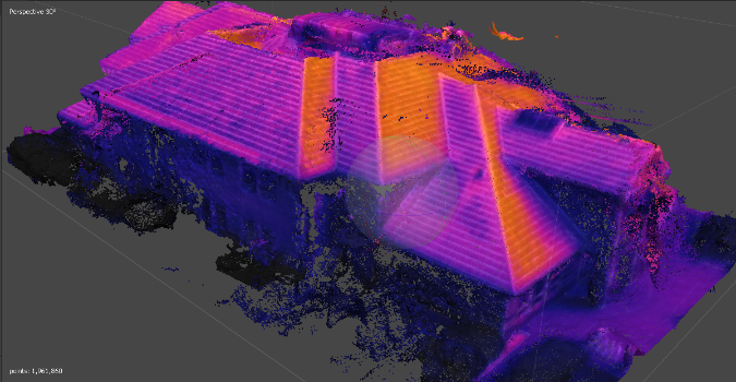
This multi-partner project will investigate the use of RPAS to model the thermal efficiency of buildings.
Fortis BC and the BC Housing Research Centre have provided funding to investigate the use of RPAS to detect and quantify methane leaks and to experiment with 3D modeling of thermal building efficiency. InDro Robotics and Aerometrix have come onboard with equipment and in-kind funding for the methane detection project. RDH Building Consultants, along with Joe Cosh from Facilities and Campus Development, are the partners on the thermal efficiency investigation.
Site selection for new campus building
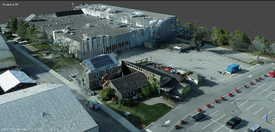
The RPAS Hub will be creating models to help BCIT choose the site for the proposed Centre for Ecological Restoration and Climate Adaptation (CERCA).
The Hub is providing BCIT Facilities and Campus Development and the architectural firm Thinkspace with a 3D texturized model, a digital surface model, and an orthomosaic map to assist with site selection for the building on the Burnaby campus.