The RPAS Hub: Drone Education, Training and Research at BCIT
The RPAS Hub is BCIT’s collaborative centre for education, training, and research in drone technology.
Drones, now referred to as remotely piloted aircraft systems or RPAS, merge aircraft technology with fields as diverse as surveying, emergency response, and equipment inspection—all areas of BCIT expertise. As British Columbia’s leader in aerospace and technology education, we are committed to ensuring the successful application of RPAS technology to learning, research, and industry.
Hub in the News
RPAS and AI: A Powerful Combination
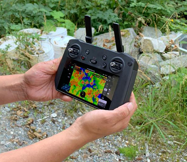
Hub member Dr. Michal Aibin is combining his research in computer vision algorithms with RPAS technology to battle wildfires and improve remote airport runway inspections. Watch his August 22 interview with Global BC: Mapping Wildfire Risk with Drones.
BCIT Disaster Day 2025
Once again, the RPAS team helped out with BCIT’s biennial emergency response training, Disaster Day. Find out more about Drones and Disaster Day First Response.
Salmon Habitat Protection
As summer temperatures rise, salmon rely on pools of cooler groundwater to thrive. Dr. Eric Saczuk been partnering with the Pacific Salmon Foundation to scan rivers for these thermal refuges in habitat preservation efforts. See A Look from Above: How Drones Can Support Salmon Battling Climate Change.
See more Hub in the News.
Offered Fall 2025: RPAS Microcredential
—check back for new offerings
Drone Applications for Environmental Risk Assessment: Taught by Dr. Eric Saczuk, this consists of four courses running consecutively Oct 6–Nov 1. Each course is four sessions, including three online classes plus one 3-hour in‑person Saturday class. The microcredential covers:
- Transport Canada regulations
- mission-planning
- image-processing techniques
- green economy metrics
Featured Projects
Search and Rescue: Real-Time Image Detection
Advancements in RPAS technology are relieving the time-sensitive, risky, and expensive task of rescuing people in BC’s backcountry.
Climate Change Research in Antarctica
Climate change is affecting the polar regions at a faster rate than anywhere in the world. But the distances and harsh climates make these regions tough to monitor. A BCIT drone expert set out to learn how drones could help capture data about the changing environment in Antarctica.
Mapping Invasive Species with Multispectral Imagery
A series of student projects used RPAS to explore a long-standing problem in natural areas management—detecting and managing invasive species. The results have real-world applications for land management and government corporations such as TransLink.
What else is going on at the Hub?
Industry Partners


Education Partners


Funding Partners