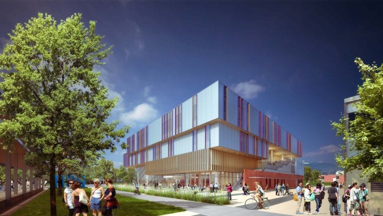
In the last two years, the new $89.9 million BCIT Health Sciences Centre has risen rapidly from the ground. Since breaking ground in December 2019, the site has gone from empty lot to a four-storey 9,909 square-metre (106,660 square-feet) building on track for completion in early 2022.
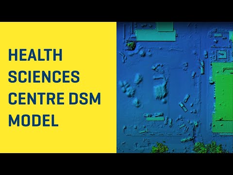
One of BCIT’s instructors has been capturing the entire transformation using state-of-the-art remotely piloted aircraft systems (RPAS, aka drone) technology. Every two weeks, Dr. Eric Saczuk, Coordinator of BCIT’s RPAS Hub and Geomatics Instructor, launches a DJI Phantom 4 RTK drone weighing just over a kilogram to fly a set route over the site. On each flight it takes more than 200 hundred still images of the project site below. These are then converted into a 3D visualisation accurate to a mere 2-3cm.
Since 2019 Eric has flown over 40 times in sunshine, snow, and clouds to create a complete record of the way the site has changed over time.
Eric explains: “The RPAS Hub contacted the School of Health Sciences because this seemed like a great opportunity to showcase drone technology in a practical setting on campus. We can demonstrate to students techniques like how to set up a flight plan to make it easier for the software to create an accurate 3D model by capturing the same area of the site multiple times to provide an added degree of accuracy.”
Flying the drones isn’t just a unique way to chart a major development. Drone technology is an important part of BCIT’s Geomatics teaching. Geomatics is the science of accurately establishing points on the earth’s surface. Students learn about the wide variety of ways to capture that data for different tasks from satellites which can cover huge areas, to field instruments that can give measurements down to the millimetre.
For construction projects like the HSC, employing drones can improve safety, efficiency, and data availability. The images acquired can be used to quickly generate accurate 3D renderings providing elevation data about features or volume estimates in a safe and timely manner to construction managers.
Examples of how drone technology can be used to visualize the Health Sciences Centre project
Beyond mapping applications (SURV 1125), BCIT offers a wide variety of drone-related courses. The institute provides training to students to help them successfully complete the Transport Canada RPAS Certification required to fly drones weighing more than 250g (RPAS 0100) and there’s even a course for media studies students, who want to capture drone footage to use in film or journalism (MDIA 3140).
Eric continues: “Drone technology has such a variety of applications so we leveraged our expertise with the technology to expand our teaching into new areas. We recently set up an elective to give students a flavor of all these applications. Every two weeks a different instructor introduces students to the use of drones in their field of expertise, including forest management, storytelling, videography and cinematography, and aeronautical engineering (RPAS 3100).”
Christie Paxton, Senior Project Manager for the Health Sciences Building adds: “One of the aims of our projects is to use them as living labs to support research and teaching at the Institute, so it’s exciting to see this fascinating way of visualising the progress on Health Sciences. We’re actually installing a drone landing pad on the roof of the new building, which we hope will support similar geomatics projects in the future.”
More About the Health Sciences Centre
Supported by INSPIRE, BCIT’s largest fundraising campaign in its 55-year history, the Health Sciences Centre is the first building to be completed as part of the Institute’s Burnaby Campus renewal plan. The INSPIRE Campaign will transform BCIT’s Burnaby campus into a dynamic new learning environment where solutions to our most urgent and complex challenges are born, tested, and readied for the world.